File:Map of Indiana highlighting Greene County.svg
From EverybodyWiki Bios & Wiki

Size of this PNG preview of this SVG file: 391 × 599 pixels. Other resolutions: 156 × 240 pixels | 313 × 480 pixels | 501 × 768 pixels | 668 × 1,024 pixels | 1,337 × 2,048 pixels | 722 × 1,106 pixels.
Original file (SVG file, nominally 722 × 1,106 pixels, file size: 42 KB)
Summary
| Description |
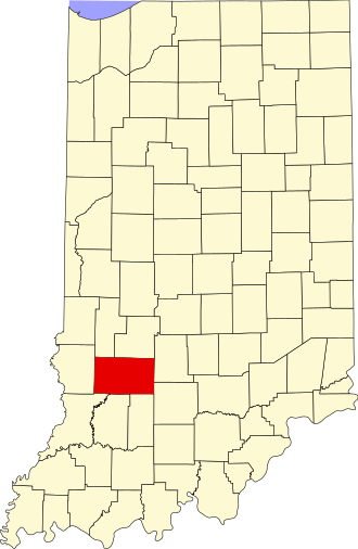
English: This is a locator map showing Greene County in Indiana. |
| Source | Own work |
| Author | David Benbennick made this map. For more information, see Commons:United States county locator maps. |
| I, the copyright holder of this work, release this work into the public domain. This applies worldwide. In some countries this may not be legally possible; if so: I grant anyone the right to use this work for any purpose, without any conditions, unless such conditions are required by law. |
File history
Click on a date/time to view the file as it appeared at that time.
| Date/Time | Thumbnail | Dimensions | User | Comment | |
|---|---|---|---|---|---|
| current | 14:37, 25 June 2024 | | 722 × 1,106 (42 KB) | wikimediacommons>Nux | uniform colors with good contrast |
File usage
The following 13 pages use this file:
- Bushrod, Indiana
- Dixon, Greene County, Indiana
- Ilene, Indiana
- Island City, Indiana
- Plummer, Indiana
- Ridgeport, Indiana
- Sponsler, Indiana
- Stalcup Corner, Indiana
- Tanner, Indiana
- Template:GreeneCountyIN-geo-stub
- Template:Greene County, Indiana
- Kept on Wikipedia:Beehunter, Indiana
- Kept on Wikipedia:Lone Tree, Indiana