Bullionville, Utah
Script error: No such module "Draft topics".
Script error: No such module "AfC topic".
Bullionville | |
|---|---|
 Bullionville Location of Bullionville in Utah  Bullionville Bullionville (the United States) | |
| Coordinates: 40°44′28.9″N 109°35′53.2″W / 40.741361°N 109.598111°WCoordinates: 40°44′28.9″N 109°35′53.2″W / 40.741361°N 109.598111°W ⧼validator-fatal-error⧽ | |
| Country | United States |
| State | Utah |
| County | Uintah |
| Established | 1887 |
| Abandoned | c. 1930's |
| Named for | Bullionville |
| Elevation | 9,050 ft (2,758 m) |
Bullionville is a ghost town in Uintah County, nestled in the Uintah Mountains in the Ashley National forest.
Geography[edit]
Located in Ashley National Forest, along Anderson Creek.
History[edit]
this town was established as a mining town in the 1880's when L. P. Dyer discovered copper ore. In 1899 A smelter was built along Anderson creek and the remains of the smelter can still be seen to this day.
Notable peoples[edit]
L. P. Dyer Willie Carter
References[edit]
External links[edit]
Municipalities and communities of Uintah County, Utah, United States | ||
|---|---|---|
| Cities | 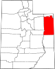 | |
| CDPs | ||
| Other communities | ||
| Indian reservation | ||
| Ghost town | ||
| Footnotes | ‡This populated place also has portions in an adjacent county or counties | |
This article "Bullionville, Utah" is from Wikipedia. The list of its authors can be seen in its historical and/or the page Edithistory:Bullionville, Utah. Articles copied from Draft Namespace on Wikipedia could be seen on the Draft Namespace of Wikipedia and not main one.