Chittagong
Chittagong চট্টগ্রাম Chattogram | |
|---|---|
|
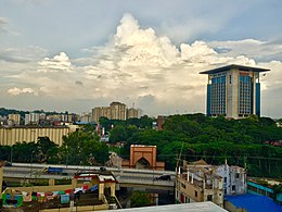
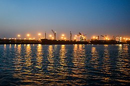
From top: Chittagong Skyline, Chittagong War Cemetery, Shah Amanat Bridge, Foy's Lake, Ethnological Museum of Chittagong, Port of Chittagong & Karnaphuli River | |
| Lua error in Module:Location_map at line 502: Unable to find the specified location map definition: "Module:Location map/data/Bangladesh Chittagong division" does not exist. | |
| Coordinates: 22°20′06″N 91°49′57″E / 22.33500°N 91.83250°ECoordinates: 22°20′06″N 91°49′57″E / 22.33500°N 91.83250°E ⧼validator-fatal-error⧽ | |
| Country | |
| Division | Chittagong Division |
| District | Chittagong District |
| Establishment | 1340 |
| Granted city status | 1863[2] |
| Government | |
| • Type | Mayor–Council |
| • Body | Chattogram City Corporation |
| • City Mayor | A J M Nasir Uddin |
| Area | |
| • Metropolis | 5,282.92 km2 (2,039.75 sq mi) |
| • Urban | 2,054.90 km2 (793.40 sq mi) |
| • Metro | 2,510 km2 (980.2 sq mi) |
| Elevation | 29 m (95 ft) |
| Population (2020) | |
| • Metropolis | 3,116,000[1] |
| • Density | 19,800/km2 (51,000/sq mi) |
| • Urban | 6,025,985 |
| • Urban density | 19,800/km2 (51,000/sq mi) |
| • Metro | 9,453,496 |
| • Metro density | 3,187/km2 (8,250/sq mi) |
| • Demonym | Chittagonian; also (colloquial): Chottogrami, Chatigaiya, Sitainga, Chittagainga |
| • Population growth rate | 2.8% |
| Demonym(s) | Chatgaiya/sãṭgãiya (চাঁটগাঁইয়া) |
| Time zone | UTC+6 (BST) |
| Postal code | 4000, 4100, 42xx |
| Calling code | +880 31 |
| Police | Chittagong Metropolitan Police |
| Metro GDP/PPP (2018) | |
| International airport | Shah Amanat International |
| Voter (2018) | 5,632,322 |
| Website | Chittagong City Corporation |
Chittagong (/tʃɪtəɡɒŋ/), officially Chattogram (Bengali: চট্টগ্রাম)[5] and known as the Port City of Bangladesh, is a major coastal city and financial centre in southeastern Bangladesh. The city has a population of more than 2.5 million[1] while the metropolitan area had a population of 4,009,423 in 2011,[1] making it the second-largest city in the country. It is the capital of an eponymous District and Division. The city is located on the banks of the Karnaphuli River between the Chittagong Hill Tracts and the Bay of Bengal. Modern Chittagong is Bangladesh's second most significant urban center after Dhaka.
Chittagong plays a vital role in the Bangladeshi economy. The Port of Chittagong, one of the world's oldest ports,[6] whose coast appeared on Ptolemy's world map, is the principal maritime gateway to the country. The port is the busiest international seaport on the Bay of Bengal and the third busiest in South Asia.[7] The Chittagong Stock Exchange is one of the country's two stock markets. Several Chittagong-based companies are among the largest industrial conglomerates and enterprises in Bangladesh. The port city is the largest base of the Bangladesh Navy and Bangladesh Coast Guard; while the Bangladesh Army and Bangladesh Air Force also maintains bases and contributes to the city's economy. Chittagong is the headquarters of the Eastern Zone of the Bangladesh Railway, having historically been the headquarters of British India's Assam Bengal Railway and East Pakistan's Pakistan Eastern Railway. A controversial ship breaking industry on the outskirts of the city, which supplies local steel but causes pollution, has come under international scrutiny.
Chittagong is an ancient seaport due to its natural harbor. It was noted as one of the largest Eastern ports by the Roman geographer Ptolemy in the 1st century. The harbor has been a gateway through southeastern Bengal in the Indian subcontinent for centuries. Arab sailors and traders, who once explored the Bay of Bengal, set up a mercantile station in the harbor during the 9th century.[8] During the 14th century, the port became a "mint town" of the Sultanate of Bengal, with the status of an administrative center.
During the 16th century, Portuguese historian João de Barros described Chittagong as "the most famous and wealthy city of the Kingdom of Bengal".[9] Portuguese Chittagong was the first European colonial settlement in Bengal. A naval battle in 1666 between the Mughal Empire and Arakan resulted in the expulsion of Portuguese pirates. British colonization began in 1760 when the Nawab of Bengal ceded Chittagong to the East India Company. During World War II, Chittagong was a base for Allied Forces engaged in the Burma Campaign. The port city began to expand and industrialize during the 1940s, particularly after the Partition of British India. During the Bangladesh Liberation War in 1971, Chittagong was site of the country's declaration of independence.
Chittagong has a high degree of religious and ethnic diversity among Bangladeshi cities, despite having an overwhelming Bengali Muslim majority. Minorities include Bengali Hindus, Bengali Christians, Bengali Buddhists, the Chakmas, the Marmas and the Bohmong.
- ↑ 1.0 1.1 1.2 "Population & Housing Census-2011: Union Statistics" (PDF). Bangladesh Bureau of Statistics. p. 39. Archived from the original (PDF) on 8 December 2015. Retrieved 15 December 2015. Unknown parameter
|url-status=ignored (help) - ↑ "History of Chittagong City Corporation". Chittagong City Corporation. Retrieved 2013-05-26.
- ↑ "Area, Population and Literacy Rate by Paurashava –2001" (PDF). Bangladesh Bureau of Statistics. Archived from the original (PDF) on 2007-06-10. Retrieved 2009-09-18. Unknown parameter
|url-status=ignored (help) - ↑ "Economics Landscape of Chittagong". chittagongchamber.com. Chittagong Chamber. Retrieved 16 October 2019.
- ↑ Mahadi Al Hasnat (2 April 2018). "Mixed reactions as govt changes English spellings of 5 district names". Dhaka Tribune. Retrieved 8 April 2018.
- ↑ "Asia and Oceania: International Dictionary of Historic Places - Google Books". Books.google.com.bd. Retrieved 2017-07-24.
- ↑ "Pangaon container terminal to get a boost". The Daily Star. 3 January 2016.
- ↑ "Arabs, the - Banglapedia".
- ↑ "Chittagong | Bangladesh".


