Derby, Missouri
Derby is an [[unincorporated community|unincorporated community[verification needed]]] in St. Francois County, in the U.S. state of Missouri.[1] Derby is located in the Old Lead Belt mining district of southeast Missouri. It is the co-type location of the Derby-Doerun Dolomite, a Cambrian rock unit geologic formation of southeast Missouri.[2] The community[verification needed] lies at the junction of Missouri Route 8 and Missouri Route 32 just south of Elvins. The St. Joe State Park lies adjacent to the community[verification needed] on the east and north. Flat River flows past the west edge of the community[verification needed].[3]
The community[verification needed] took its name from the Derby Lead Company.[4]
References
- ↑ U.S. Geological Survey Geographic Names Information System: Derby, Missouri
- ↑ Thompson, Thomas L., 2001, Lexicon of Stratigraphic Nomenclature in Missouri, Missouri Department of Natural Resources, Division of Geology and Land Survey, Report of Investigation Number 73, p 83-4
- ↑ Flat River, MO, 7.5 Minute Topographic Quadrangle, USGS, 1958 (1982 rev.)
- ↑ "St. Francois County Place Names, 1928–1945". The State Historical Society of Missouri. Archived from the original on June 24, 2016. Retrieved November 27, 2016. Unknown parameter
|url-status=ignored (help)
Municipalities and communities of Saint Francois County, Missouri, United States | ||
|---|---|---|
| Cities | 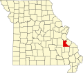 | |
| Townships | ||
| CDPs | ||
| Other unincorporated communities | ||
| Ghost towns | ||
| Footnotes | ‡This populated place also has portions in an adjacent county or counties | |
Coordinates: 37°49′30″N 90°32′19″W / 37.82500°N 90.53861°W
| This Saint Francois County, Missouri state location article is a stub. You can help EverybodyWiki by expanding it. |
This article "Derby, Missouri" is from Wikipedia. The list of its authors can be seen in its historical and/or the page Edithistory:Derby, Missouri. Articles copied from Draft Namespace on Wikipedia could be seen on the Draft Namespace of Wikipedia and not main one.
