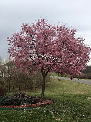
Loudoun Valley Estates, Virginia

Loudoun Valley Estates is a census-designated place (CDP) in Loudoun County, Virginia. The population as of the 2010 United States Census was 3,656.[1] It is a Toll Brothers community located near the planned Ashburn metro station complex and Moorefield Station town center in Ashburn, VA. Loudoun Valley Estates is governed by a homeowner's association.[2]
It was formerly part of the county planning commission's Urban Policy Area but has been removed.[3] The community is served by the Loudoun County Parkway.[4]
Geography[edit]
The land around Loudoun Valley Estates is flat. The average elevation is 88 meters.[5] There are about 442 people per square kilometer around the heavily populated Loudoun Valley Estates.[6]
The climate is humid subtropical.[7] The average temperature is 14 ° C . The warmest month is August, at 25 ° C , and the coolest January, at 0 ° C.[8] The average rainfall 1,188 millimeters per year. The wettest month was October, at 128 millimeters of rain, and the least wet was November, at 54 millimeters.[9]
Demographics[edit]
According to the 2010 census, Loudoun Valley Estates had a population of 3,656. Of this, 29.3% were white; 4.2% African American; 0.3% were American Indians and Alaska Natives; 61% were Asian; 0.0% Hawaiians and other Pacific Islanders; 1.1% from another race, and 4.1% from two or more races. 3.3% of the total population were Hispanic or Latino of any race.[1]
Notable residents[edit]
Survivor contestant Reem Daly lives in Loudoun Valley Estates.[10]
References[edit]
- ↑ 1.0 1.1 Virginia Trend Report 2: State and Complete Places (Sub-state 2010 Census Data). Missouri Census Data Center. Accessed 2011-02-25.
- ↑ HOA Information
- ↑ Supervisors Dive into Urban Planning
- ↑ Loudoun County Parkway Extension Set for Opening
- ↑ Loudon Valley Estates Geonames.org
- ↑ "NASA Earth Observations: Population Density". NASA/SEDAC. Retrieved January 30, 2016.
- ↑ Peel, M C; Finlayson, B L (2007). "Updated world map of the Köppen-Geiger climate classification". Hydrology and Earth System Sciences. 11 (5): 1633–1644. Bibcode:2007HESS...11.1633P. doi:10.5194/hess-11-1633-2007. Retrieved January 30, 2016.
- ↑ "NASA Earth Observations Data Set Index". NASA. Retrieved January 30, 2016.
- ↑ "NASA Earth Observations: Rainfall (1 month - TRMM)". NASA/Tropical Rainfall Monitoring Mission. Retrieved January 30, 2016.
- ↑ ‘Survivor’ journey officially ends for Ashburn resident Reem Daly
| Wikimedia Commons has media related to [[commons:Lua error in Module:WikidataIB at line 466: attempt to index field 'wikibase' (a nil value).|Lua error in Module:WikidataIB at line 466: attempt to index field 'wikibase' (a nil value).]]. |
Coordinates: 38°58′51″N 77°30′28″W / 38.98083°N 77.50778°W
This article "Loudoun Valley Estates, Virginia" is from Wikipedia. The list of its authors can be seen in its historical and/or the page Edithistory:Loudoun Valley Estates, Virginia. Articles copied from Draft Namespace on Wikipedia could be seen on the Draft Namespace of Wikipedia and not main one.

|
This page exists already on Wikipedia. |

