Oat Valley, California
Oat Valley (Pomo language: Bal-lo’ ki)[1] is a former settlement in Yolo County, California. It was originally located 10 miles (16 km) southwest of Dunnigan and moved to a location 7 miles (11 km) northeast of Capay in 1873.[2]
A post office operated at Oat Valley from 1869 to 1875.[2]
References
- ↑ Chestnut, Victor King (1902). Plants used by the Indians of Mendocino County, California. Government Printing Office. p. 404. Retrieved 24 August 2012. Search this book on

- ↑ 2.0 2.1 Durham, David L. (1998). California's Geographic Names: A Gazetteer of Historic and Modern Names of the State. Clovis, Calif.: Word Dancer Press. p. 461. ISBN 1-884995-14-4. Search this book on
Municipalities and communities of Yolo County, California, United States | ||
|---|---|---|
| Cities | 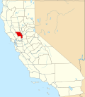 | |
| CDPs | ||
| Unincorporated communities |
| |
| Ghost towns | ||
| Footnotes | ‡This populated place also has portions in an adjacent county or counties | |
"Yolo County, California" is an invalid category parameter for Template:Coord missing.
The problem is usually caused either by a spelling mistake or by an-over-precise category.
For a full list of categories, see Category:Unclassified articles missing geocoordinate data and its subcategories.
| This Yolo County, California-related article is a stub. You can help EverybodyWiki by expanding it. |
This article "Oat Valley, California" is from Wikipedia. The list of its authors can be seen in its historical and/or the page Edithistory:Oat Valley, California. Articles copied from Draft Namespace on Wikipedia could be seen on the Draft Namespace of Wikipedia and not main one.
