Rogers, Logan County, Kentucky
From EverybodyWiki Bios & Wiki
Rogers, Kentucky | |
|---|---|
| Lua error in package.lua at line 80: module 'Module:Location map/data/USA Kentucky' not found. | |
| Coordinates: 36°52′38″N 86°47′31″W / 36.87722°N 86.79194°WCoordinates: 36°52′38″N 86°47′31″W / 36.87722°N 86.79194°W ⧼validator-fatal-error⧽ | |
| Country | United States |
| State | Kentucky |
| County | Logan |
| Elevation | 679 ft (207 m) |
| Time zone | UTC-6 (Central (CST)) |
| • Summer (DST) | UTC-5 (CDT) |
| Area code(s) | 270 |
| GNIS feature ID | 2743096[1] |
Rogers is an unincorporated community in Logan County, Kentucky, United States. Rogers is located on Kentucky Route 722 5.7 miles (9.2 km) east-northeast of Russellville.[2]
References[edit]
- ↑ "Rogers". Geographic Names Information System. United States Geological Survey.
- ↑ State Primary Road System: Logan County (PDF) (Map). Kentucky Transportation Cabinet. 2013. Retrieved June 9, 2013.
Municipalities and communities of Logan County, Kentucky, United States | ||
|---|---|---|
| Cities | 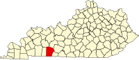 | |
| CDP | ||
| Other unincorporated communities | ||
| Footnotes | ‡This populated place also has portions in an adjacent county or counties | |
| This Logan County, Kentucky state location article is a stub. You can help EverybodyWiki by expanding it. |
This article "Rogers, Logan County, Kentucky" is from Wikipedia. The list of its authors can be seen in its historical and/or the page Edithistory:Rogers, Logan County, Kentucky. Articles copied from Draft Namespace on Wikipedia could be seen on the Draft Namespace of Wikipedia and not main one.