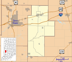
Shady Lane, Indiana
From EverybodyWiki Bios & Wiki
Shady Lane | |
|---|---|
| Coordinates: 39°32′44″N 87°08′01″W / 39.54556°N 87.13361°WCoordinates: 39°32′44″N 87°08′01″W / 39.54556°N 87.13361°W ⧼validator-fatal-error⧽ | |
| Country | United States |
| State | Indiana |
| County | Clay |
| Township | Brazil |
| Elevation | 653 ft (199 m) |
| GNIS feature ID | 443250[1] |
Shady Lane is an unincorporated community in Brazil Township, Clay County, Indiana. It is part of the Terre Haute Metropolitan Statistical Area.
Shady Lane was named from its tree-lined streets.[2]
Geography[edit]
Shady Lane is located at 39°32′44″N 87°08′01″W / 39.54556°N 87.13361°W
⧼validator-fatal-error⧽
.
References[edit]
- ↑ "Shady Lane, Indiana". Geographic Names Information System. United States Geological Survey. Retrieved 2010-08-20.
- ↑ Baker, Ronald L. (October 1995). From Needmore to Prosperity: Hoosier Place Names in Folklore and History. Indiana University Press. p. 298. ISBN 978-0-253-32866-3.
...name from the rows of sycamore trees...
Search this book on
Template:ClayCountyIN-geo-stub
This article "Shady Lane, Indiana" is from Wikipedia. The list of its authors can be seen in its historical and/or the page Edithistory:Shady Lane, Indiana. Articles copied from Draft Namespace on Wikipedia could be seen on the Draft Namespace of Wikipedia and not main one.

