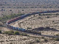
Shawmut, Arizona
Shawmut, Arizona | |
|---|---|
 Long container train eastbound at Shawmut, Arizona | |
| Coordinates: 32°59′49″N 112°30′14″W / 32.99694°N 112.50389°WCoordinates: 32°59′49″N 112°30′14″W / 32.99694°N 112.50389°W ⧼validator-fatal-error⧽ | |
| Country | United States |
| State | Arizona |
| County | Maricopa |
| Elevation | 1,293 ft (394 m) |
| Time zone | UTC-7 (Mountain (MST)) |
| • Summer (DST) | UTC-7 (MST) |
| Area code(s) | 623 |
| FIPS code | 04-65840 |
| GNIS feature ID | 24611 |
Shawmut is a site where pusher locomotives would assist trains through a mountain pass in Maricopa County, Arizona.[2] It has an estimated elevation of 1,293 feet (394 m) above sea level.[1]
The part of the Sunset Route railroad that passes through Shawmut does so at a 1% gradient.[3]
Shawmut features in the Left Coast Rail Video's production Union Pacific Sunset Route Hot Spots-Shawmut to Red Rock.[4]
References[edit]
- ↑ 1.0 1.1 "Feature Detail Report for: Shawmut". Geographic Names Information System. United States Geological Survey.
- ↑ "Shawmut Trainspotting Loop, AZ". HikeArizona.COM. Retrieved 2020-02-22.
- ↑ Steve Schmollinger, Images of Western Railroading, Voyageur Press. ISBN 9781610604123, p.165
- ↑ "Union Pacific Sunset Route Hot Spots Shawmut to Red Rock". www.leftcoastrailvideos.com. Retrieved 2023-03-13.
This article "Shawmut, Arizona" is from Wikipedia. The list of its authors can be seen in its historical and/or the page Edithistory:Shawmut, Arizona. Articles copied from Draft Namespace on Wikipedia could be seen on the Draft Namespace of Wikipedia and not main one.


