Three V Crossing (low-water crossing)
Three V Crossing | |
|---|---|
 Three V Crossing | |
| Coordinates | Lua error in Module:Coordinates at line 611: attempt to index field 'wikibase' (a nil value). |
| Carries | Vvv Road |
| Crosses | Little Missouri River |
| Locale | Slope County, North Dakota. GNIS feature ID 1035208[1] |
| Characteristics | |
| Design | Low-water crossing |
| Material | concrete |
| Lua error in Module:Infobox_mapframe at line 118: attempt to index field 'wikibase' (a nil value). | |
Three V Crossing is a low-water crossing in Slope County, North Dakota, United States. Three V Crossing is located on the Little Missouri River 19.1 miles (30.7 km) north-northeast of Marmarth and 27 miles (43 km) northwest of Amidon[2] within the Little Missouri National Grassland in an unorganized part of Slope County in T. 135 N R. 105 W.[3]
The construction of the crossing was jointly funded by the National Forest Service program and the county.[2][4] It is part of Forest Development Road (FDR) 7741.[5] Water underneath passes through concrete box culverts.[6] Access across the Missouri River is unreliable when waters are high.[7]
On the east side of the crossing, a geological layer known as the Rhame Bed is characterized by having yellowish sand, with very pale green material underneath.[8]
Ranch[edit]
Three V Ranch is nearby.[9] Historically, the VVV Ranch was a multi-state cattle operation,[10] with the VVV brand dating back to 1898. This particular ranch property had previously been founded in 1883 as the JXL ranch, or Yule Ranch,[11] but after changing hands was renamed as the VVV Ranch in 1937. At one time it was home to a small community including a post office, general store, and a stage coach stop. The post office closed in 1910.[12] Today the ranch raises Angus cattle, grows cash crops, and caters to hunters looking for mule and whitetail deer, coyotes and sharptail grouse. Theodore Roosevelt enjoyed staying at the ranch[13] and conducted one of his last bison hunting excursions there.[14][15]
References[edit]
- ↑ "Three V Crossing". Geographic Names Information System. United States Geological Survey.
- ↑ 2.0 2.1 Newspaper clipping from The Bismarck Tribune, 16 Dec 1996
- ↑ Slope County Map, ND DOT website
- ↑ Golden Valley Board of County Commissioners Minutes, January 3, 2002, pages 5 and 21
- ↑ Forest Service interactive map of Three V Crossing
- ↑ Transcript of Alternatives Public Workshop, Little Missouri River Crossing Environmental Impact Statement, July 22, 2008, page 17
- ↑ No Bridge no problem Just Drive Across the Little Missouri River, beautifulbadlandsnd.com
- ↑ The Rhame bed (Slope Formation, Paleocene), a silcrete and deep weathering profile, in southwestern North Dakota by Barbara D. Wehrfritz, M.S. Thesis, 1978, page 52, page 43 of the pdf
- ↑ The Little Missouri River is a great challenge to cross, beautifulbadlandsnd.com
- ↑ Open Range Ranching in North Dakota 1870s-1910s, page 46 of the pdf
- ↑ Alex LaSotta entry, North Dakota Cowboy Hall of Fame
- ↑ Yule (Slope County) entry, from Origins of North Dakota Place Names by Mary Ann Barnes Williams, page 201 (page 293 of the pdf), reprinted 1972 by the McLean County Historical Society
- ↑ Roosevelt in the Bad Lands, Volume 1 by Hermann Hagedorn, Houghton Mifflin, 1921, page 262
- ↑ Ranch Favored by Roosevelt is a Cowboy Hall Inductee, The Dickinson Press, August 2, 2006
- ↑ VVV Ranch - Weinreis Brothers entry, North Dakota Cowboy Hall of Fame
Municipalities and communities of Slope County, North Dakota, United States | ||
|---|---|---|
| Cities | 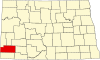 | |
| Unincorporated communities | ||
| This North Dakota location article is a stub. You can help EverybodyWiki by expanding it. |
This article "Three V Crossing (low-water crossing)" is from Wikipedia. The list of its authors can be seen in its historical and/or the page Edithistory:Three V Crossing (low-water crossing). Articles copied from Draft Namespace on Wikipedia could be seen on the Draft Namespace of Wikipedia and not main one.