Yethonat, Washington
From EverybodyWiki Bios & Wiki
Yethonat, Washington | |
|---|---|
 Yethonat, Washington Location of Yethonat, Washington  Yethonat, Washington Yethonat, Washington (Washington (state)) | |
| Coordinates: 46°24′16″N 120°23′47″W / 46.4045725°N 120.3964478°WCoordinates: 46°24′16″N 120°23′47″W / 46.4045725°N 120.3964478°W Fatal error: The format of the coordinate could not be determined. Parsing failed. [1] | |
| Country | United States |
| State | Washington |
| County | Yakima |
| Elevation | 810 ft (247 m) |
| Time zone | UTC-8 (Pacific (PST)) |
| • Summer (DST) | UTC-7 (PDT) |
| ZIP code | 98951 |
| Area code(s) | 509 |
| GNIS feature ID | 1511444[2] |
Yethonat is an unincorporated community in Yakima County, Washington, United States. The community developed along the Toppenish, Simcoe and Western Railway Company line. Yethonat is located between Wapato and Toppenish off U.S. Route 97 and is a small, rural agricultural community.
References
- ↑ "Yethonat". Geographic Names Information System. United States Geological Survey. Retrieved 2012-10-25.
- ↑ 2.0 2.1 "US Board on Geographic Names". United States Geological Survey. 2007-10-25. Retrieved 2008-01-31.
Municipalities and communities of Yakima County, Washington, United States | ||
|---|---|---|
| Cities | 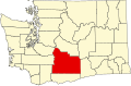 | |
| Towns | ||
| CDPs | ||
| Other unincorporated communities | ||
| Indian reservation | ||
| Footnotes | ‡This populated place also has portions in an adjacent county or counties | |

| This Yakima County, Washington state location article is a stub. You can help EverybodyWiki by expanding it. |
This article "Yethonat, Washington" is from Wikipedia. The list of its authors can be seen in its historical and/or the page Edithistory:Yethonat, Washington. Articles copied from Draft Namespace on Wikipedia could be seen on the Draft Namespace of Wikipedia and not main one.
