Alps, Georgia
From EverybodyWiki Bios & Wiki
Alps, Georgia | |
|---|---|
 Alps  Alps | |
| Coordinates: 33°8′53″N 84°36′12″W / 33.14806°N 84.60333°WCoordinates: 33°8′53″N 84°36′12″W / 33.14806°N 84.60333°W Fatal error: The format of the coordinate could not be determined. Parsing failed. | |
| Country | United States |
| State | Georgia |
| County | Meriwether |
| Elevation | 850 ft (260 m) |
| Time zone | UTC-5 (Eastern (EST)) |
| • Summer (DST) | UTC-4 (EDT) |
| GNIS feature ID | 354290[1] |
Alps is an unincorporated community located in Meriwether County, Georgia, United States.
A post office called Alps was established in 1890 and remained in operation until 1910.[2] The community was located inland, away from the railroads.[3]
References
- ↑ "Alps". Geographic Names Information System. United States Geological Survey.
- ↑ "County". Jim Forte Postal History. Retrieved 6 September 2017.
- ↑ Candler, Allen Daniel; Evans, Clement Anselm (1906). Georgia: Comprising Sketches of Counties, Towns, Events, Institutions, and Persons. State historical association. p. 53. Search this book on

Municipalities and communities of Meriwether County, Georgia, United States | ||
|---|---|---|
| Cities | 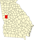 | |
| Towns | ||
| Unincorporated communities | ||
| Footnotes | ‡This populated place also has portions in an adjacent county or counties | |
| This Meriwether County, Georgia state location article is a stub. You can help EverybodyWiki by expanding it. |
This article "Alps, Georgia" is from Wikipedia. The list of its authors can be seen in its historical and/or the page Edithistory:Alps, Georgia. Articles copied from Draft Namespace on Wikipedia could be seen on the Draft Namespace of Wikipedia and not main one.

|
This page exists already on Wikipedia. |
