Apricot, Washington
From EverybodyWiki Bios & Wiki
Apricot, Washington Apricot Spur | |
|---|---|
 Apricot, Washington Location of Apricot, Washington | |
| Coordinates: 46°14′11″N 119°51′27″W / 46.2365213°N 119.8575366°WCoordinates: 46°14′11″N 119°51′27″W / 46.2365213°N 119.8575366°W Fatal error: The format of the coordinate could not be determined. Parsing failed. [1] | |
| Country | United States |
| State | Washington |
| County | Benton |
| Elevation | 823 ft (251 m) |
| Time zone | UTC-8 (Pacific (PST)) |
| • Summer (DST) | UTC-7 (PDT) |
| ZIP code | 99350 |
| Area code(s) | 509 |
| GNIS feature ID | 1510784[2] |
Apricot is an unincorporated community in Benton County, Washington, United States, located between Prosser and Grandview.
The community was established in 1916 and probably named Apricot "for the fine apricot land offered" by the land agent of the Yakima Irrigating and Improvement Company. The community was once a railroad siding for the Northern Pacific Railroad.[4][5]
References
- ↑ "Apricot". Geographic Names Information System. United States Geological Survey. Retrieved 2012-10-28.
- ↑ 2.0 2.1 "US Board on Geographic Names". United States Geological Survey. 2007-10-25. Retrieved 2008-01-31.
- ↑ "U.S. Census website". United States Census Bureau. Retrieved 2008-01-31.
- ↑ "Washington Place Names database". Tacoma Public Library. Archived from the original on September 5, 2012. Retrieved October 31, 2012. Unknown parameter
|url-status=ignored (help) - ↑ "Station Roster Master List: Apricot". Northern Pacific Railway Historical Association. Retrieved October 31, 2012.
Municipalities and communities of Benton County, Washington, United States | ||
|---|---|---|
| Cities | 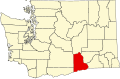 | |
| CDPs | ||
| Unincorporated communities | ||
| Ghost towns | ||

| This Benton County, Washington state location article is a stub. You can help EverybodyWiki by expanding it. |
This article "Apricot, Washington" is from Wikipedia. The list of its authors can be seen in its historical and/or the page Edithistory:Apricot, Washington. Articles copied from Draft Namespace on Wikipedia could be seen on the Draft Namespace of Wikipedia and not main one.