Bluestem, Washington
From EverybodyWiki Bios & Wiki
Bluestem, Washington | |
|---|---|
 Bluestem, Washington | |
| Coordinates: 47°31′30″N 118°07′36″W / 47.52500°N 118.12667°WCoordinates: 47°31′30″N 118°07′36″W / 47.52500°N 118.12667°W Fatal error: The format of the coordinate could not be determined. Parsing failed. | |
| Country | United States |
| State | Washington |
| County | Lincoln |
| Elevation | 2,335 ft (712 m) |
| Time zone | UTC-8 (Pacific (PST)) |
| • Summer (DST) | UTC-7 (PDT) |
| ZIP code | 99122 |
| Area code(s) | 509 |
| GNIS feature ID | 1531409[1] |
Bluestem is an unincorporated community in Lincoln County, in the U.S. state of Washington.[2]
History
A post office called Bluestem was established in 1906, and remained in operation until 1951.[3] The community was named for the bluestem wheat field near the original town site.[4]
References
- ↑ U.S. Geological Survey Geographic Names Information System: Bluestem, Washington
- ↑ U.S. Geological Survey Geographic Names Information System: Bluestem, Washington
- ↑ "Post Offices". Jim Forte Postal History. Archived from the original on 6 March 2016. Retrieved 18 July 2016. Unknown parameter
|url-status=ignored (help) - ↑ Meany, Edmond S. (1923). Origin of Washington geographic names. Seattle: University of Washington Press. p. 24. Search this book on

Municipalities and communities of Lincoln County, Washington, United States | ||
|---|---|---|
| Cities | 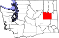 | |
| Towns | ||
| Unincorporated communities | ||
| Ghost town | ||
| This Lincoln County, Washington state location article is a stub. You can help EverybodyWiki by expanding it. |
This article "Bluestem, Washington" is from Wikipedia. The list of its authors can be seen in its historical and/or the page Edithistory:Bluestem, Washington. Articles copied from Draft Namespace on Wikipedia could be seen on the Draft Namespace of Wikipedia and not main one.
