Burchell, California
From EverybodyWiki Bios & Wiki
Burchell | |
|---|---|
Former settlement | |
 Burchell Location in California | |
| Coordinates: 37°15′44″N 120°17′14″W / 37.26222°N 120.28722°WCoordinates: 37°15′44″N 120°17′14″W / 37.26222°N 120.28722°W Fatal error: The format of the coordinate could not be determined. Parsing failed. | |
| Country | United States |
| State | California |
| County | Merced County |
| Elevation | 236 ft (72 m) |
Burchell is a former settlement in Merced County, California.[1] It was located on the Atchison, Topeka and Santa Fe Railroad 2.5 miles (4 km)southeast of Planada,[2] at an elevation of 236 feet (72 m).[1] It still appeared on USGS maps as of 1918.[1]
References
- ↑ 1.0 1.1 1.2 1.3 U.S. Geological Survey Geographic Names Information System: Burchell, California
- ↑ Durham, David L. (1998). California's Geographic Names: A Gazetteer of Historic and Modern Names of the State. Clovis, Calif.: Word Dancer Press. p. 752. ISBN 1-884995-14-4. Search this book on

Municipalities and communities of Merced County, California, United States | ||
|---|---|---|
| Cities | 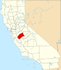 | |
| CDPs | ||
| Unincorporated communities | ||
| Ghost towns |
| |
| Stub icon | This Merced County, California-related article is a stub. You can help EverybodyWiki by expanding it. |
This article "Burchell, California" is from Wikipedia. The list of its authors can be seen in its historical and/or the page Edithistory:Burchell, California. Articles copied from Draft Namespace on Wikipedia could be seen on the Draft Namespace of Wikipedia and not main one.
