Chalwa
From EverybodyWiki Bios & Wiki

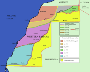
Chalwa or Cnalwa is a settlement in central Western Sahara.[1][2][3] It is in the Moroccan-controlled area of the former territory, some 100 kilometres west of Sebaiera and 150 kilometres south of Aridal, to which it is connected by road.
References[edit]
- ↑ Department of Field Support, Cartographic Section (February 2009), Map No. 3691 Rev. 58 United Nations (PDF), United Nations, archived from the original (PDF) on 10 February 2018, retrieved 15 October 2020
- ↑ Department of Field Support, Cartographic Section (13 April 2009), Map No. 3691 Rev. 59 United Nations (PDF), United Nations, archived from the original (PDF) on 15 October 2020, retrieved 15 October 2020
- ↑ Department of Field Support, Cartographic Section (October 2012), Map No. 3175 Rev. 4 United Nations (PDF), United Nations, archived from the original (PDF) on 13 October 2020, retrieved 15 October 2020
Further reading[edit]
- Marchand, J; Bronner, G; Sougy, J (1984), "Notice explicative de la feuille Chalwa", Notes Mém Serv Géol Maroc (in French), 344 (7)CS1 maint: Unrecognized language (link)
External links[edit]
- Map of Western Sahara. United Nations.
| This article about a location within Western Sahara is a stub. You can help EverybodyWiki by expanding it. |
This article "Chalwa" is from Wikipedia. The list of its authors can be seen in its historical and/or the page Edithistory:Chalwa. Articles copied from Draft Namespace on Wikipedia could be seen on the Draft Namespace of Wikipedia and not main one.
