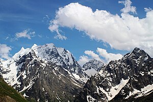
Extreme points of Abkhazia
From EverybodyWiki Bios & Wiki
Script error: No such module "AfC submission catcheck".
This is a list of the extreme points and extreme elevations in Abkhazia.[lower-alpha 1]
Extreme points of Abkhazia (approximate).
Extreme points[edit]
| Heading | Location | Administrative entity | Bordering entity | Coordinates[lower-alpha 2] | References |
|---|---|---|---|---|---|
| North | At the river Psou | Gagra District | Krasnodar Krai, Russia | 43°35′11″N 40°14′31″E / 43.586401°N 40.242028°E ⧼validator-fatal-error⧽ | |
| South | At the Black Sea, near the mouth of river Enguri | Gali District | Samegrelo-Zemo Svaneti, Georgia | 42°24′43″N 41°32′59″E / 42.412019°N 41.549770°E ⧼validator-fatal-error⧽ | |
| East | In the mountainous area east of Kodori Valley | Ochamchira District | Samegrelo-Zemo Svaneti, Georgia | 43°11′14″N 42°08′24″E / 43.187233°N 42.139959°E ⧼validator-fatal-error⧽ | |
| West | At the mouth of river Psou, near the Black Sea | Gagra District | Krasnodar Krai, Russia | 43°23′26″N 40°00′25″E / 43.390650°N 40.006970°E ⧼validator-fatal-error⧽ |
Extreme altitude[edit]

| Extremity | Name | Altitude | Location | District | Coordinates[lower-alpha 2] |
|---|---|---|---|---|---|
| Highest | Dombay-Ulgen | 4,046 m (13,274 ft)[1] | Russian border | Gulripshi District | 43°14′40″N 41°43′34″E / 43.244444°N 41.726111°E ⧼validator-fatal-error⧽ |
| Lowest | Black Sea | 0 m (0 ft) | Along the coastline of Abkhazia | N/A | N/A |
Notes[edit]
- ↑ Abkhazia is a partially recognized state. While being de facto independent, most countries recognize Georgian sovereignity over Abkhazia.
- ↑ 2.0 2.1 Coordinates obtained from Google Earth. Google Earth makes use of the WGS84 geodetic reference system.
References[edit]
See also[edit]
This article "Extreme points of Abkhazia" is from Wikipedia. The list of its authors can be seen in its historical and/or the page Edithistory:Extreme points of Abkhazia. Articles copied from Draft Namespace on Wikipedia could be seen on the Draft Namespace of Wikipedia and not main one.

