Jayapuram
Jayapuram | |
|---|---|
| Coordinates: 17°32′22″N 79°48′48″E / 17.539404°N 79.813281°ECoordinates: 17°32′22″N 79°48′48″E / 17.539404°N 79.813281°E ⧼validator-fatal-error⧽ | |
| Country | India |
| State | Telangana |
| District | Mahabubabad (Manukota) |
| Talukas | Mahabubabad |
| Languages | |
| • Official | Telugu |
| Time zone | UTC+5:30 (IST) |
| PIN | 506324 |
| Telephone code | 91-8719 |
| Vehicle registration | TS 03 |
| Website | telangana |
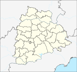
Jayapuram is a village in Narsimhulapet Mandal in Mahabubabad district (also called as Manukota) of the state of Telangana, India.[1]. Jayapuram is part of Dornakal constituency in Telangana Legislative Assembly.[2]
Geography[edit]
Jayapuram is located 8 kilometers from the Warangal Khammam highway. 3 Kilometers from Mandal Headquarters Narsimhulapet, 25 Kilometers away from Mahabubabad and 30 Kilometers away from Thorrur.
Temples[edit]
- Sri Seetharamalayam.
References[edit]
- ↑ "Mandal wise villages" (PDF). Revenue Department - AP Land. National Informatics Center. p. 7. Archived from the original (PDF) on 19 December 2014. Retrieved 20 November 2014.
- ↑ List of constituencies of Telangana Legislative Assembly
This article "Jayapuram" is from Wikipedia. The list of its authors can be seen in its historical and/or the page Edithistory:Jayapuram. Articles copied from Draft Namespace on Wikipedia could be seen on the Draft Namespace of Wikipedia and not main one.


