Lawyers Bar, California
From EverybodyWiki Bios & Wiki
Coordinates: 41°52′10″N 123°49′53″W / 41.86944°N 123.83139°W
⧼validator-fatal-error⧽
Lawyers Bar | |
|---|---|
Former settlement | |
 Lawyers Bar Location in California | |
| Coordinates: 41°52′10″N 123°49′53″W / 41.86944°N 123.83139°W ⧼validator-fatal-error⧽ | |
| Country | United States |
| State | California |
| County | Del Norte County |
| Elevation | 899 ft (274 m) |
Lawyers Bar (also, Sawyers Bar)[2] was a settlement in Klamath County now Del Norte County, California, United States. It was located on the Middle Fork of the Smith River,[2] at an elevation of 899 feet (274 m). It still appeared on maps as of 1922.
References[edit]
- ↑ U.S. Geological Survey Geographic Names Information System: Lawyers Bar, California
- ↑ 2.0 2.1 Durham, David L. (1998). California's Geographic Names: A Gazetteer of Historic and Modern Names of the State. Clovis, Calif.: Word Dancer Press. p. 139. ISBN 1-884995-14-4. Search this book on

External links[edit]
Municipalities and communities of Del Norte County, California, United States | ||
|---|---|---|
| City | 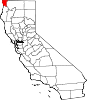 | |
| CDPs | ||
| Unincorporated communities | ||
| Indian reservations | ||
| Ghost towns | ||
| This Del Norte County, California-related article is a stub. You can help EverybodyWiki by expanding it. |
This article "Lawyers Bar, California" is from Wikipedia. The list of its authors can be seen in its historical and/or the page Edithistory:Lawyers Bar, California. Articles copied from Draft Namespace on Wikipedia could be seen on the Draft Namespace of Wikipedia and not main one.