Marlman, Colorado
From EverybodyWiki Bios & Wiki
Marlman, Colorado | |
|---|---|
| Coordinates: 38°05′36″N 103°20′54″W / 38.093273°N 103.348341°WCoordinates: 38°05′36″N 103°20′54″W / 38.093273°N 103.348341°W ⧼validator-fatal-error⧽ | |
| Country | |
| State | |
| Counties | Bent[1] |
| Elevation | 6,719 ft (2,048 m) |
| Time zone | UTC-7 (MST) |
| • Summer (DST) | UTC-6 (MDT) |
| ZIP code[2] | 81050 (La Junta) |
Marlman is an unincorporated community in Bent and Otero counties in the state of Colorado. It served as a railroad stop on the Holly & Swink branch of the Atchison, Topeka and Santa Fe Railway from 1909 to 1920.[3] The U.S. Post Office at La Junta (ZIP Code 81050) now serves Marlman postal addresses.[2]
Marlman lies north of SH 194 12.75 miles northeast of La Junta and 6 miles west of Las Animas, the county seat and the largest city of the county.
See also[edit]
References[edit]
- ↑ 1.0 1.1 "U.S. Board on Geographic Names". United States Geological Survey. Retrieved 1 February 2022.
- ↑ 2.0 2.1 "ZIP Code Lookup". United States Postal Service. December 27, 2006. Archived from the original (JavaScript/HTML) on November 22, 2010. Retrieved December 27, 2006. Unknown parameter
|url-status=ignored (help) - ↑ Donald R. Elliott; Doris L. (Salmen) Elliott (1999). "Placenames of Colorado" (PDF). Denver Public Library. Colorado Council of Genealogical Societies, Inc. Denver, Colorado. Retrieved 1 February 2022.
Municipalities and communities of Bent County, Colorado, United States | ||
|---|---|---|
| City |  | |
| CDPs | ||
| Unincorporated communities | ||
| Ghost town | ||
| Footnotes | ‡This populated place also has portions in an adjacent county or counties | |
Municipalities and communities of Otero County, Colorado, United States | ||
|---|---|---|
| Cities | 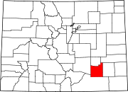 | |
| Towns | ||
| CDPs | ||
| Unincorporated communities | ||
| Ghost town | ||
| Footnotes | ‡This populated place also has portions in an adjacent county or counties | |
| This Colorado-related article is a stub. You can help EverybodyWiki by expanding it. |
This article "Marlman, Colorado" is from Wikipedia. The list of its authors can be seen in its historical and/or the page Edithistory:Marlman, Colorado. Articles copied from Draft Namespace on Wikipedia could be seen on the Draft Namespace of Wikipedia and not main one.