Monticello Fire
| Monticello Fire | |
|---|---|
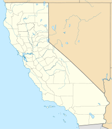
| Location | Vaca Mountains, Yolo County, California |
| Coordinates | 38°30′43″N 122°06′14″W / 38.512°N 122.104°WCoordinates: 38°30′43″N 122°06′14″W / 38.512°N 122.104°W ⧼validator-fatal-error⧽ |
| Statistics[1] | |
| Date(s) | July 4, 2014 – July 12, 2014 |
| Burned area | 6,488 acres (2,626 ha) |
| Cause | Fireworks |
| Non-fatal injuries | 5 |
| Map | |
The Monticello Fire was a firework-caused wildfire that started in the late evening of July 4, 2014 near the Monticello Dam west of the town of Winters in Yolo County, California.[1] By July 6, the fire had consumed over 5,000 acres (2,000 ha) of chaparral and brush and was 30 percent contained.[2] It was contained on July 12, after scorching an estimated 6,488 acres (2,626 ha).
Events[edit]
The fire was reported around 9:30 p.m. on Friday, July 4, and quickly grew in size due to dry and and erratic windy conditions.[3] By 11 p.m. that night the fire was 100 acres, and by 4 a.m. the next morning it was already 1,000 acres, according to Winters City Manager John Donlevy who added that, "...the hills are literally tinder-dry."[2] Highway 128 west of Winters was shut down due to the fire while thirty-four structures at Golden Bear Estates were immediately threatened, resulting in the mandatory evacuation of residents in that area.[2] A separate voluntary evacuation order for the Canyon Creek Resort campground was also put into effect but lifted later that day.[2] As the fire burned north into rugged, steep terrain, access to the area became difficult, limiting firefighting operations.[3]An American Red Cross Shelter was immediately set up at Winters Community Center at 4 a.m. that Saturday morning for over 40 evacuees.[2]
By Saturday afternoon, the fire had reportedly tripped in size to over 5,000 acres (2,000 ha) as containment hovered at a mere 15 percent.[4]
On Sunday, July 6, containment of the Monticello fire grew to 30 percent as at least 1,275 firefighters were reported battling the blaze.[5] Fire conditions remained volatile as wind directors switched several times throughout the day, reached gusts of up to 20 mph.[5]
All evacuation orders were lifted on Monday, July 7 as containment of the fire grew to 45 percent, with over 1,750 fire personnel on hand.[6] Within the following days, containment lines grew and by July 11, the incident was 95 percent contained with investigators still trying to determine the cause of the fire.[7] The fire was finally contained on July 12, after destroying 6,488 acres (26.26 km2), however no structures were damaged. The cause of the fire was later determined to be fireworks related.[8]
References[edit]
- ↑ 1.0 1.1 "Monticello Fire". CALFIRE. Retrieved July 5, 2014.
- ↑ 2.0 2.1 2.2 2.3 2.4 Aleaziz, Hamed. "Monticello Fire forces evacuation of homes near Lake Berryessa". SFGate. Retrieved 6 July 2014.
- ↑ 3.0 3.1 Rocha, Veronica. "Monticello fire in Yolo County scorches more than 6,400 acres". LA Times. Retrieved 7 July 2014.
- ↑ Shams, Sharokina. "Homes evacuated as fire near Winters explodes in size". KCRA-TV. Retrieved 5 July 2014.
- ↑ 5.0 5.1 Sernoffsky, Evan; Garofoli, Joe. "Monticello Fire near Lake Berryessa covers almost 6,500 acres". SFGate. Retrieved 6 July 2014.
- ↑ Sernoffsky, Evan; Williams, Kale. "Evacuations lifted in fire near Lake Berryessa". SFGate. Retrieved 7 July 2014.
- ↑ Brekke, Dan. "Cal Fire Still Looking for Cause of Massive Monticello Blaze". KWED. Retrieved 11 July 2014.
- ↑ Cameron, Katrina; Kurhi, Eric. "Fourth of July gone bad: Fireworks casualty warns of holiday hazard". Mercury News. Retrieved 1 July 2015.
| This wildfire-related article is a stub. You can help EverybodyWiki by expanding it. |
This article "Monticello Fire" is from Wikipedia. The list of its authors can be seen in its historical. Articles copied from Draft Namespace on Wikipedia could be seen on the Draft Namespace of Wikipedia and not main one.

