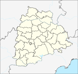
Namathpally
From EverybodyWiki Bios & Wiki
Namathpally | |
|---|---|
Village | |
| Coordinates: 17°27′26″N 78°56′01″E / 17.457117°N 78.933487°ECoordinates: 17°27′26″N 78°56′01″E / 17.457117°N 78.933487°E ⧼validator-fatal-error⧽ | |
| Country | |
| State | Telangana |
| District | Yadadri Bhuvanagiri district |
| Languages | |
| • Official | Telugu |
| Time zone | UTC+5:30 (IST) |
| PIN | 508285 |
| Telephone code | 08685 |
| Vehicle registration | TS |
| Nearest city | Hyderabad |
| Lok Sabha constituency | Bhongiri |
| Vidhan Sabha constituency | Bhongiri |
| Website | telangana |
Namathpally is a village in Yadadri Bhuvanagiri district of Telangana, India.[1][2][3][4][5][6] It falls under Bhongir mandal. It has Thukkapur on its North, Yerrambelly on East, Anajipur on West and Nandanam on South.
References[edit]
- ↑ "Polling Station Location Namathpally". Election commission of India. Retrieved 2018-02-24.
- ↑ "Google Maps Namathpally". maps.google.com. Retrieved 2018-02-23.
- ↑ "Namathpally Home page". wikiedit. Retrieved 2018-02-24.
- ↑ "Polling Station #26 Namathpally". elections.in. Retrieved 2018-02-24.
- ↑ "Namathpally Village". onefivenine.com. Retrieved 2018-02-23.
- ↑ "Village.org Namathpally". village.org.in. Retrieved 2018-02-23.
| This article about a location in Nalgonda district, Telangana is a stub. You can help EverybodyWiki by expanding it. |
Namathpally[edit]
This article "Namathpally" is from Wikipedia. The list of its authors can be seen in its historical and/or the page Edithistory:Namathpally. Articles copied from Draft Namespace on Wikipedia could be seen on the Draft Namespace of Wikipedia and not main one.


