Shirley, Kings County, California
From EverybodyWiki Bios & Wiki
Shirley | |
|---|---|
 Shirley Location in California  Shirley Shirley (the United States) | |
| Coordinates: 36°23′55″N 119°39′51″W / 36.39861°N 119.66417°WCoordinates: 36°23′55″N 119°39′51″W / 36.39861°N 119.66417°W ⧼validator-fatal-error⧽ | |
| Country | |
| State | |
| County | |
| Elevation | 79 m (259 ft) |
Shirley (formerly, Harlow) is an unincorporated community in Kings County, California.[1] It is located on the Atchison, Topeka and Santa Fe Railroad 4.5 miles (7.2 km) north of Hanford,[2] at an elevation of 259 feet (79 m).[1]
References[edit]
- ↑ 1.0 1.1 1.2 U.S. Geological Survey Geographic Names Information System: Shirley, Kings County, California
- ↑ Durham, David L. (1998). California's Geographic Names: A Gazetteer of Historic and Modern Names of the State. Clovis, Calif.: Word Dancer Press. p. 1105. ISBN 1-884995-14-4. Search this book on

Municipalities and communities of Kings County, California, United States | ||
|---|---|---|
| Cities | 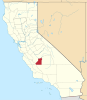 | |
| CDPs | ||
| Unincorporated communities | ||
| Ghost towns | ||
| This Kings County, California-related article is a stub. You can help EverybodyWiki by expanding it. |
This article "Shirley, Kings County, California" is from Wikipedia. The list of its authors can be seen in its historical and/or the page Edithistory:Shirley, Kings County, California. Articles copied from Draft Namespace on Wikipedia could be seen on the Draft Namespace of Wikipedia and not main one.