Surveying


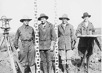
Surveying is the technique and science of accurately finding out the position[1] of points and the distances and angles between them. These points are usually, but not always, associated with positions on the surface of the Earth. They are often used to make land maps and boundaries for ownership of land. A person who does the surveying is called a surveyor. In order to find the information they need, surveyors use geometry, engineering, trigonometry, mathematics, physics, geology and law.
Surveying has been very important in the development of the human environment since the beginning of recorded history (ca. 5000 years ago) and it is a requirement planning of nearly every form of construction. Its most common uses are in the fields of transport, building and construction, communications, mapping, and the making of legal boundaries for land ownership.
Origins[edit]
Surveying has existed throughout much of our history. In ancient Egypt, when the Nile River overflowed its banks and washed out farm boundaries, the boundaries were recreated by surveyors using simple geometry. The construction of the pyramids, including the Great Pyramids of Giza (built c. 2700 BC) show us that the Ancient Egyptians used surveying efficiently.
Surveyor[edit]
A surveyor is a person who has the skills to accurately find out the position of points and the distances and angles between them. These points are usually, positions on the surface of the Earth. Finding these points is called "surveying". Surveyors are needed to make land maps and boundaries for ownership of land. In order to find the information they need, surveyors use geometry, engineering, trigonometry, mathematics, physics, and law.
There are different types of surveyor. A construction or building surveyor is the person who has to make sure that buildings are being put up in the correct place and fit in with planning and building laws.[2] A quantity surveyor is the person who keeps track of costs on a building project. A hydrographic surveyor measures features to do with water, such as rivers, lakes and oceans. A marine surveyor inspects ships. A mine surveyor is the person who finds out the position of underground mines, for example gold mines or coal mines.[3]
Related pages[edit]
Notes[edit]
- ↑ terrestrial or three-dimensional space
- ↑ "About Building Surveyors". aibs.businesscatalyst.com. 2011. Archived from the original on 11 May 2011. Retrieved 15 May 2011. Unknown parameter
|url-status=ignored (help) - ↑ "AIMS - The Australian Institute of Mine Surveyors". minesurveyors.com.au. 2011. Archived from the original on 16 February 2011. Retrieved 15 May 2011. Unknown parameter
|url-status=ignored (help)
References[edit]
- Keay J (2000), The Great Arc: the dramatic tale of how India was mapped and Everest was named, Harper Collins, 182pp, ISBN 0-00-653123-7 Search this book on
 ..
.. - Pugh J C (1975), Surveying for Field Scientists, Methuen, 230pp, ISBN 0-416-07530-4 Search this book on
 .
.
Other websites[edit]
- National Society of Professional Surveyors Archived 2006-04-26 at the Wayback Machine
- The Irish Institution of Surveyors
- National Geodetic Survey
- National Council of Examiners for Engineering and Surveying
- UK Ordnance Survey
- U.S. Geological Survey
- International Federation of Surveyors
- The Institution of Surveyors, Australia Archived 2007-12-01 at the Wayback Machine
- The Survey Association (UK)
- Survey of India
- New Zealand Institute of Surveyors
