Araz, California
From EverybodyWiki Bios & Wiki
Araz | |
|---|---|
Former settlement | |
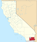
 Araz Location in California | |
| Coordinates: 32°45′13″N 114°41′36″W / 32.75361°N 114.69333°WCoordinates: 32°45′13″N 114°41′36″W / 32.75361°N 114.69333°W Fatal error: The format of the coordinate could not be determined. Parsing failed. [1] | |
| Country | United States |
| State | California |
| County | Imperial County |
| Elevation | 47 ft (154 m) |
Araz (formerly, Pilot Knob) is a former settlement in Imperial County, California.[2] It was located on the Southern Pacific Railroad 8.5 miles (14 km) west-southwest of Bard.[2]
References
- ↑ 1.0 1.1 U.S. Geological Survey Geographic Names Information System: Araz
- ↑ 2.0 2.1 Durham, David L. (1998). California's Geographic Names: A Gazetteer of Historic and Modern Names of the State. Clovis, Calif.: Word Dancer Press. p. 1389. ISBN 1-884995-14-4. Search this book on

| This Imperial County, California-related article is a stub. You can help EverybodyWiki by expanding it. |
This article "Araz, California" is from Wikipedia. The list of its authors can be seen in its historical and/or the page Edithistory:Araz, California. Articles copied from Draft Namespace on Wikipedia could be seen on the Draft Namespace of Wikipedia and not main one.
